
Strategic advantages of Man o' war Bay, pages 13, 14 & 15
[page 13]
to admit, the most direct and extensive uses of it,- In
conquest or Command.
Man ‘o’ war Bay,- is the station I advert to;- It is the
great feature of Tobago, on which I most rely in suggesting
the important and imperial uses, which may be derived from
the Possession of this Island,- if turnd to full Account.
The annexd sketch was taken, on my last tour of survey,
descending from the Eastern Heights,- when on the brow of
the observatory Hill, the view suddenly opend of the noble
Bason of Manowar Bay shining beneath, smooth as a mirror.
The drawing will give a just idea of the Nature of the
Country [environing?] the Harbour, & of its strong headlands:
and I add a Chart of the Bay,- with the Soundings taken by
the French Captains Dubrüys & [Duciet?] in the year 1785.
Two Rivulets flow into the Bay,- and further, for watering, a
pure and perennial Spring gushes out within an hundred
yards of the Beach:- on the Table of the Highest Hill towering
behind the Bay, is a small lake of fresh water, for the supply
of that Commanding station.
East of the line of soundings from the Entrance, the curve
markd “The Pyrates carenage” from Capt Roberts, and other
noted Buccaneers, Having there resorted in the beginning of the last

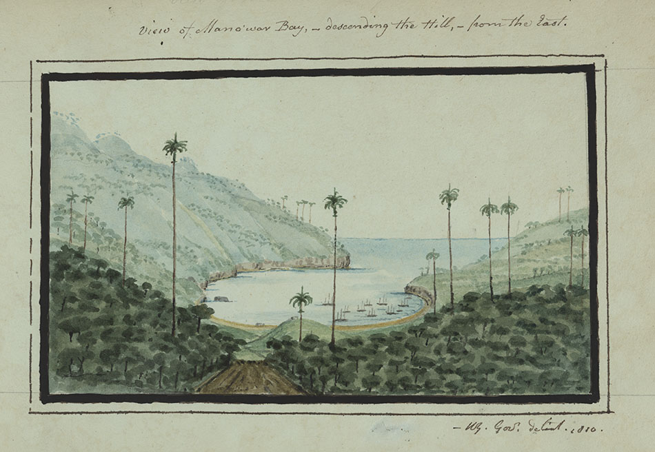 View of Man o’ war Bay, descending the hill from the east, page 14The illustration reproduced to the left provides a scenic view of Man o’ war Bay. Young was clearly an adept artist and his paintings complement his words and descriptions of the island.
The palm trees and heavy shrubbery paint a picture of an untainted landscape, one which is potentially free for building upon.
There are a few ships located in the bay itself which may well have been there while Young himself was painting. It is not possible to discern what kind of ships they are, but he is likely aiming to show that this is a safe harbour.
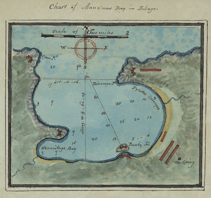 Chart of Mano’war Bay in Tobago, page 15The second image, to the right, shows Young’s detailed plans for Man o’ war Bay. This chart includes information important to anyone assessing the naval potential of the bay as a harbour for ships.
Latitude and longitude are marked, as are the soundings of the bay. There is also a scale given to further aid the reader’s understanding of the bay’s geography and capabilities.
The red markings shown are explicitly referred to in the text as potential places for setting up barracks and batteries of defence, supporting Young’s proposal for Man o’war bay to be his primary port of defence of the island, as he claimed it was ‘impossible to be blockaded.’
Other smaller details are also shown, including the rivulets that feed into the bay. Also on the chart is a small blue dot called ‘The Spring.’ This is perhaps shown in its close proximity to the bay to indicate a supply of drinking water, and to help aid the notion that stationing a large contingent of troops here would not prove difficult in terms of supplying them with clean drinking water.
In this exhibition
- Background information
- Gallery and transcription
- Introducing the Essay
- Natural resources of the island
- Natural resources, page 11
- Man o' war Bay and its importance, page 12
- Strategic advantages of Man o' war Bay, pages 13, 14 & 15
- Defence of the bay, page 16
- Securing against France, page 17
- Further fortifications at Courland, page 18
- Tobago's relative position
- The Commercial & political importance of the island of Tobago
- The Commercial & political importance of the island, continued
- Port of enterprize and command, page 29
- Orinoco River, page 30
- Appeal to British merchants, page 31
- Historical political instability of the island, page 32
- The reach of the Orinoco River, page 33
- Potential trade agreements with Spain, page 34
- Further trade routes with South America, page 35
- Establishing the port of Courland, page 36
- Prospects of national advantage, page 37
- Conclusions
- Military significance of Man o' war Bay, page 38
- Further significances, page 39
- Military consensus, page 40
- French intentions for the island, page 41
- Suitability as a port for ships of war, page 42
- Relative safety of the island, page 43
- The necessity to prepare for conflict, page 44
- Revelations of an inside source, page 45
- Fas est, et ab hoste doceri, page 46
- Select bibliography