
Introducing the island of Tobago, pages 3, 4 and 5
The two images reproduced here are placed at the beginning of Young’s Essay. The first page of text proper follows these and is at the bottom of this webpage.
 Chart of the West Indies, page 3The chart reproduced here - like all the illustrations in the work it was made by Young - displays the position of Tobago, the Caribbean archipelago and the northern coast of South America.
Tobago is highlighted as being on the 11th parallel, significant as a marker for indicating the type of weather to be expected in Tobago; and prevalent trade winds are also highlighted.
A detailed map of the Orinoco River, a focus for one of Young’s arguments emphasising the importance of the development of the island, is also evident.
The map’s accuracy should be treated with caution, with borders on the northern coast of South America particularly questionable. However the delineation of these territories does mark their general positioning.
Tobago’s size relative to Trinidad and other islands has also been slightly exaggerated, likely due to Young attempting to emphasise Tobago’s prominence.
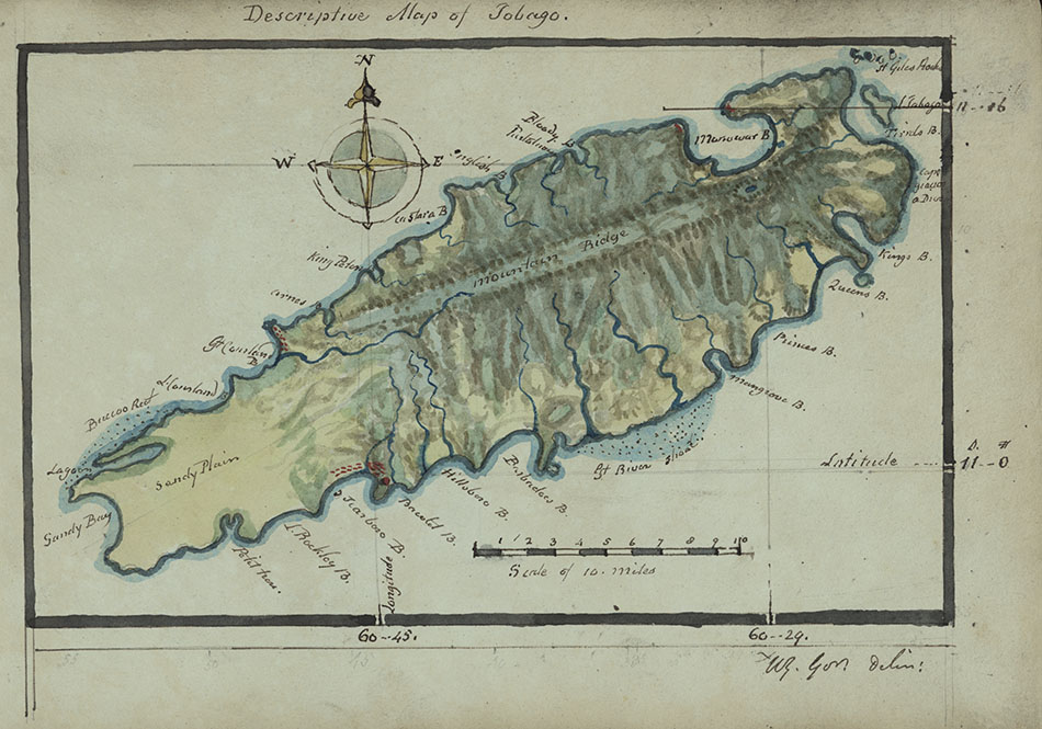 Map of the island of Tobago, page 4The map reproduced to the right shows a detailed geography of the island including rivers, mountains, the general terrain and topography.
All of the bays and rivulets mentioned in the Essay can be seen in the image - and also some natural features that are not mentioned. There are some markings in red on the image of the island indicating (potential) man-made structures, such as settlements or potential military or commercial outposts.
A scale is given to help the reader envision more accurately the total size of the island, and the precise bearings and lines of latitude and longitude are also given to provide perspective on Tobago’s relative positioning.
Features around the coast are also highlighted, including a few smaller islands of the eastern coast, such as Little Tobago, and potential hazards for ships, such as St Giles Rocks and the coral reefs.
[page 5]
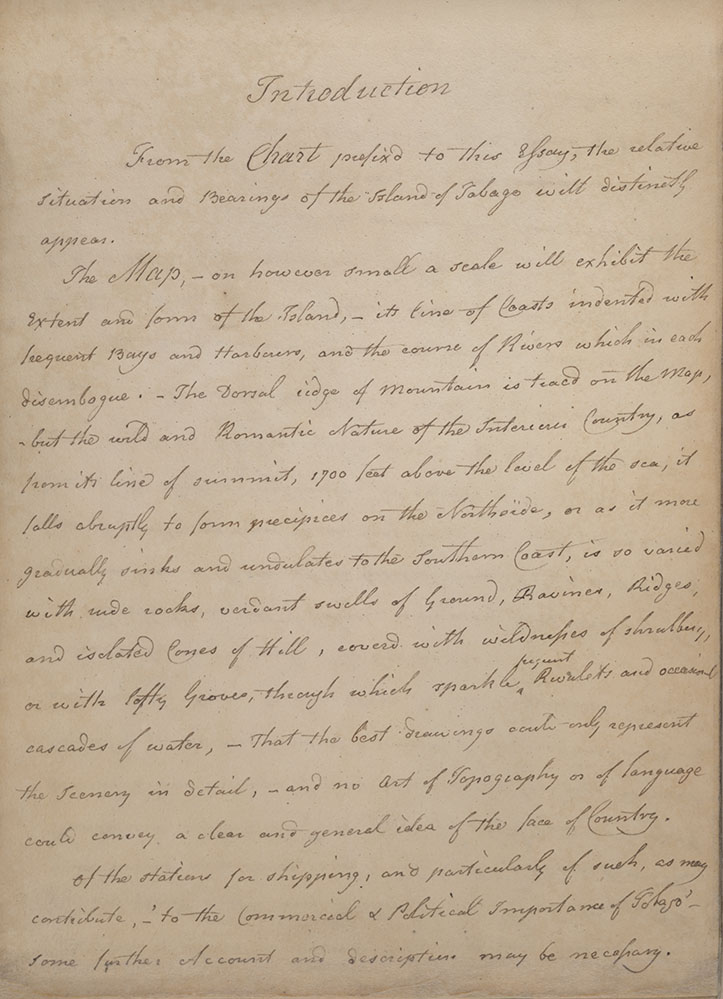
Introduction
From the Chart prefixd to this Essay, the relative
situation and Bearings of the Island of Tabago will distinctly
appear.
The Map, - on however small a scale will exhibit the
extent and form of the Island, - its line of Coasts indented with
frequent Bays and Harbours, and the course of Rivers which in each
disembogue. – The Dorsal ridge of Mountains is tracd on the Map,
-but the wild and Romantic Nature of the interior Country, as
from its line of summit, 1700 feet above the level of the sea, it
falls abruptly to form precipices on the Northside, or as it more
gradually sinks and undulates to the Southern Coast, is so varied
with wide rocks, verdant swells of Ground, Ravines, Ridges,
and isolated Cones of Hill, covered with wildnesses of shrubbery,
or with lofty Groves, through which sparkle frequent Rivulets and occasional
cascades of water, - That the best drawings could only represent
the scenery in detail,- and no art of topography or of language
could convey a clear and general idea of the face of country.
Of the stations for shipping, and particularly of such, as may
contribute,- ‘ to the Commercial & Political Importance of Tobago’-
some further Account and description may be necessary
In this exhibition
- Background information
- Gallery and transcription
- Introducing the Essay
- Dedication leaf and initial pages, 1 and 2
- Introducing the island of Tobago, pages 3, 4 and 5
- Introducing the island of Tobago, continued, pages 6 and 7
- Climate and geography, page 8
- Climate and geography, continued, page 9
- Casualty reports from 1808 and 1809, page 10
- Natural resources of the island
- Tobago's relative position
- The Commercial & political importance of the island of Tobago
- The Commercial & political importance of the island, continued
- Port of enterprize and command, page 29
- Orinoco River, page 30
- Appeal to British merchants, page 31
- Historical political instability of the island, page 32
- The reach of the Orinoco River, page 33
- Potential trade agreements with Spain, page 34
- Further trade routes with South America, page 35
- Establishing the port of Courland, page 36
- Prospects of national advantage, page 37
- Conclusions
- Military significance of Man o' war Bay, page 38
- Further significances, page 39
- Military consensus, page 40
- French intentions for the island, page 41
- Suitability as a port for ships of war, page 42
- Relative safety of the island, page 43
- The necessity to prepare for conflict, page 44
- Revelations of an inside source, page 45
- Fas est, et ab hoste doceri, page 46
- Select bibliography