
An early journey across the isthmus
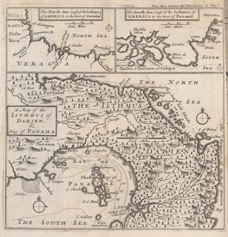 A late 17th century map of the isthmus from William Dampier's New voyage round the world ...Though William Dampier's buccaneering exploits make for exciting reading, as his group of 44 traverse the perilous Isthmus of Darien, killing monkeys and local game and avoiding the pursuing Spaniards, his journey time of 21 days was not greatly propitious for the burgeoning trade links needed to connect the new world and Europe.
Although he states that the indigenous Indians could undertake the journey, across the country now known as Panama, from the 'South Sea to the North' in 'a day and a half', the transport of Peruvian bullion and Californian gold necessitated a maritime trade route that did not entail sailing the long distance around Cape Horn.
The strategic significance of and need for a waterway taking ships across the Isthmus of Darien had been recognised early in the European colonisation of Latin America, when in 1534 the king of Spain ordered a survey of a route to be undertaken. Britain, as a historic maritime power and trading nation, clearly had an interest in the various plans for a canal that followed, though none came to fruition for many years.
The opening shown here is a late 17th century map of the isthmus.
In this exhibition
- Rogues and rebels
- Colonialism
- Liberation?
- British emigration to Latin America
- The Falkland Islands: a question of sovereignty
- The Panama canal and the influence of the United States in Latin America
- An early journey across the isthmus
- Plans for the Panama Canal
- The U.S. and its mighty project
- Ethnicity and Latin America
- The politics and suffering of the region
- Indigenous peoples
- Latin America observed
- 'That land so rich'
- Bibliography