
The Strand environs
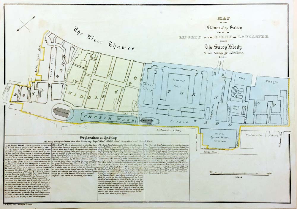 Manor of the Savoy 1830To the north of where King's College now stands was the Church of St Mary and the Innocents that counted Thomas Becket as one of its rectors. Until its demolition by the Protector Somerset in the mid-16th century, it was located fractionally to the south of the present church. The replacement, by Gibbs, was consecrated in 1723.
The spot was also home to London's tallest maypole, at over one hundred feet, and London's first hackney cab rank from 1636. The Aldwych area was redeveloped in the late nineteenth and early twentieth centuries when old slums were removed and Kingsway and the present buildings constructed.
The land to the east of Strand Lane and south of St Clement Danes was drained by the Knights Templar in the middle ages and later became the site of the palaces of the Bishops of Exeter and of Bath and Wells.
Essex House and Arundel House, the London residences of two of Tudor and Stuart England's leading noble families, replaced them. Essex House was the nerve centre of the Earl of Essex's ill-fated rebellion against Elizabeth I in 1601, while Arundel House was home to the Howard Earls of Arundel and later Dukes of Norfolk. The house was demolished in 1678 and Howard, Norfolk, Surrey and Arundel Streets quickly built in its place.
King's present properties in Surrey Street were built along the western boundary of the Arundel Estate.
In this exhibition
- Foundation
- The site
- The building
- Staff and students
- College life